Old mills' hydraulics in the upper Amadorio River, Relleu (Marina Baixa), Alacant, Spain.
Int. J. Global Environmental Issues, Vol. X, No. Y, xxxx 1
Copyright © 20XX Inderscience Enterprises Ltd.
Old mills’ hydraulics in the upper Amadorio River,
Relleu (Marina Baixa), Alacant, Spain
Miquel Salgot*
Faculty of Pharmacy,
University of Barcelona,
Soil Science Unit,
Joan XXIII, s/n. 08028 Barcelona, Spain
Email: salgot@ub.edu
*Corresponding author
Manuel A. Soler
Casa de l’Escrivà.,
Pça., Senyoria no. 2. 03578 Relleu, Alicante, Spain
Email: alqueriasoler@telefonica.net
Abstract: The purpose of this paper is to show the efficiency, in terms of
energy, of the ancient mills’ infrastructures composed by little dams, channels
and mills, working as a stairs of hydropower systems in the Relleu
municipality, Alacant province, Spain. A very big difference among the
efficiency of the ancient systems and the technology of today has been found. It
is difficult to find money to retrofit the old infrastructures because the possible
profits obtained will not be enough to recover the costs incurred, even
considering the benefits derived from the upholding of the industrial heritage,
an immaterial and intangible asset. In past times, conditions of technology,
building, living and economy were very different than today and it was possible
to invest time, money and workforce in building and using old hydropower
facilities. The remains of this industrial heritage are there to show how difficult
is to evaluate the profitability of an investment depending on changing
circumstances.
Keywords: water heritage; old mills; old water culture; material and
immaterial heritage; Relleu; Alacant; Spain.
Reference to this paper should be made as follows: Salgot, M. and Soler, M.A.
(xxxx) ‘Old mills’ hydraulics in the upper Amadorio River, Relleu (Marina
Baixa), Alacant, Spain’, Int. J. Global Environmental Issues, Vol. X, No. Y,
pp.xxx–xxx.
Biographical notes: Miquel Salgot received his PhD in Pharmacy from
University of Barcelona. He is Associate Professor of Soil Science and
Agricultural Chemistry (University of Barcelona) and member of the Catalonia
Royal Academy of Pharmacy. His current research interests include wastewater
reclamation and reuse and water-related history. He has authored and edited
several books on non-conventional water resources and wastewater treatment.
He is author of more than 100 refereed papers on wastewater reclamation and
reuse.
1d11
2 M. Salgot and M.A. Soler
Manuel A. Soler received his PhD in Engineering from Polytechnic University
of Catalonia. He is Hydraulic Engineer in Paul Sabatier University, Toulouse,
France, former Professor on Fluid Mechanics in Polytechnic University of
Catalonia, and consultant in water projects, waterworks and management in
several public and private companies. He is author of books on pumping,
environmental management and water supply; and several papers on scientific
journals.
This paper is a revised and expanded version of a paper entitled ‘Hydraulic
heritage in a dry country, Relleu, Alicante, Spain (EU)’ presented at IWA
Regional Symposium on Water, Wastewater and Environment: Traditions and
Culture, Patras, Greece, 22–24 March 2014.
1 Introduction
The number of water mills and where they were built depended on the vicinity of the
population to be served and on the fields where cereals were produced as well as on the
availability of flowing water and the related climatic and topographic conditions. That
happened between 500 and 200 years ago, when citizens needed the approval of the
aristocratic landowner to implement any initiative (Soler, circa 1800).
Figure 1 Relleu and Amadorio river location (see online version for colours)
Relleu (named Benesit in the old times) is a small village in the Marina Baixa region
(Alacant, Spain), near the Mediterranean seaside (Figures 1 and 2). Relleu is located in
the upper part of the catchment of the river Amadorio, not far from the Aitana (meaning
mother) Mountains, just where the arid climate begins and the annual rainfall drops from
600 mm to 300 mm within a distance of few kilometres (Sendra, 1969). Rainfall arrives
2d11
Old mills’ hydraulics in the upper Amadorio River, Relleu (Marina Baixa) 3
approximately in October pouring in few hours from 50 to 130 mm, as it is said that in
this country ‘rain do not know how to fall’. Evapotranspiration is around 700 mm/year,
bigger than rainfall.
Figure 2 Google earth view of the river Amadorio with the Tosca mills (see online version
for colours)
Due to the need to regulate water flows for irrigation, mill wheat and other cereals,
important series of infrastructures were built in the neighbourhood of the village,
comprising channels, mills, reservoirs and dams.
Very likely, the first mill built was the Molí Vell (old mill), erected not far from the
actual village of Relleu. The remains of the Molí Vell are in a place where water flow and
water fall used to be enough to power the mill, constructed with very few civil works and
reduced investment. Not far away, upstream the river, there are two other mills, La Tosca
de Dalt and La Tosca de Baix (Upper and Lower Tosca), where the Amadorio’s flow rate
increases because water coming from the Tosca spring is added to the flow. Another
cereal mill, named Rabós or Palanquetes’, was built upriver, in an unknown time, where
the Amadorio is joined by two affluents, Garrigós’ and Escuders’ tributaries, in a place
named La Batana (Salgot and Soler, 2014).
‘Batan or batana’ is a special mill to produce natural textile fibre from vegetables as
flax, cannabis and some other which could be grown and collected at the river side and
unused banks in the upper part of the Amadorio. Lately, downwards the channel was built
the Llixandre (old name of Alexander) or de l’Horta mill. When the channel reaches
Relleu, the Molí de Dalt and the Molí de Baix can be found. From the Molí Vell onwards,
the channel is used to fed the other mills and for irrigation purposes. Broad explanations
3d11
4 M. Salgot and M.A. Soler
about the river, the mills and other water infrastructures can be found in the paper ‘Water
heritage in Relleu (Marina Baixa) arid region, Alicante, Spain’ from the same authors,
presented at the IWA Regional Symposium on Water, Wastewater and Environment:
Traditions and Culture, 22–24 March, Patras, Greece.
The main hydraulic details of the mills and channels of the river Amadorio near
Relleu will be highlighted in the following section.
2 Methodology
2.1 Hydrological considerations
The river Amadorio starts in the skirts of Aitana’s Mountains which stop the clouds
coming from the Iberian peninsula in such a way that a climatic border is created. In the
north side of the mountains the average rainfall is more than 700 mm while in the south
side only 300 mm are registered at the head of the Amadorio’s river catchment and, along
the river rainfall decreases quickly to 150 mm at the Mediterranean seaside. The rainfall
is present mainly during September and October and the river-base flow stands until
April, May or June depending on the part of the precipitation which is in form of snow
and on the intensity of the rain (intensities bigger than 150 mm/h have been registered).
Because rainfall is decreasing along the river path and because water is extracted from
the river for other purposes until it becomes dry, enough flow rates to power mills are
nowadays present only in the upper part of the catchment, where the mills are located.
2.2 Topographical considerations
The work basis have been Google Earth, Google Maps, Simpac (from the Spanish
Central Administration), Terrasit (belonging to the Generalitat Valenciana Autonomous
Administration) and the Topographic Map of the City Hall of Relleu or TMCHR. Google
Earth and the TMCHR have been very useful.
A GPS in each mill has to be used to locate its components in the map. The levels
from the GPS cannot be used because they are too inaccurate, so the average error on the
GPS that was 7 m east-west and 9 m north-south was corrected and the positions were
fixed more accurately (Figure 2). Once the position has been fixed we used the TMCHR
to obtain the level of each point. The data about head and water level are approximate to
the real one, not exactly known and could be cleared depending of further and more
precise topographical works. 10 m of hydraulic head in each mill is assumed.
2.3 The infrastructure of the mills
To generate power, water was derived from the river and reached the mill by a little
channel towards the ‘balsa’ or water reservoir/pond of the mill. The ‘balsa’ was
connected with the tower or chimney, named ‘pou’ or ‘cup’. At the basis of the tower it is
a cave (the ‘cacau’), where the exit of water from the tower (the segitia or sagetia) is
found. The exit is controlled by a wooden vane (the ‘morrera’) which, when open, forms
a jet that impacts on the blades of the turbine. The turbine has an axis made of wood or
iron called ‘arbre’ (tree) if made on wood and ‘palaferro’ if made on iron. The shape of
the tower is like a ziggurat of three or four levels. The tower wall is made of stones. The
4d11
Old mills’ hydraulics in the upper Amadorio River, Relleu (Marina Baixa) 5
thickness of the wall is larger on the base and smaller on the top. Thickness is the
appropriate to support the strength generated by the hydrostatic water pressure. The tower
is around 10 or 11 m high (Benesit, 2013; Climent, 2013; Soler, 1996).
Turbines (wheels) are located at the open air, so when examining the blades the
system is similar to a Francis turbine, but they work as a reaction one or a Pelton type. At
the beginning, turbines were made of pine green wood [Figure 3(a)]. The resin of pine
waterproofs wood and then the turbine became nearly eternal. Turbines on wood were
substituted by iron ones [Figure 3(b)] because the energetic efficiency of the iron turbines
was higher than the one from turbines made on wood.
Figure 3 (a) Artisan Vicente el Sacristà (†) with a blade made of wood (b) An iron turbine
(La Tosca) (see online version for colours)
When calculating the hydraulics and energy parameters of the mill, the data found are:
head or elevation capacity 11 m, flow rate 0,025 m3/s, maximum section of the jet 0.1 Å~
0.05 m2, speed of the turbine 90 r.p.m., radius of the turbine 0.7 m and deflection angle of
the blades 120°. Water speed of the jet was 10.3 m/s, peripheral speed 3.3 m/s (very close
to the optimum 1/3 of 10.3 m/s), force in the blade 2245 N, torch 85.75 Nm and power
863.28 Nm/s (Benesit, 2013; Soler, 1996).
Each mill was offering in a year a maximum production capacity, depending of the
hydrology and axis system, of around 250,000 kg of grain (cereals, wheat, barley and
corn) (Barciela at al., 2013; Fontana et al., 2012).
The description of non-hydraulic machinery as filters or mill stones is not presented
here. When the non-consumptive use of water of a single mill finished, after losing head,
5d11
6 M. Salgot and M.A. Soler
then water was caught for feeding a new mill; so mills were constructed one after another
along the river and were even using water from the irrigation system because, very often,
all water flowing on the river was extracted by the irrigation system and the remnants
were returned there. Little by little water availability resources decreased along the
centuries and it became necessary to supply additional power with engines and
electricity.
The first mill upwards in the area is located at the beginning of river Amadorio, just
after the junction of two tributaries, river Garrigós and river Escuders. As indicated, the
name of this mill is Palanquetes or Rabós [Figure 4(a)]. There was registered the first
death caused by a work-related accident. The owner, Rabós, went inside the ‘cacau’ or
gallery where the hydraulic turbine was placed. At that moment there was not water jet
because the orifice was clogged by debris. He tried to unclog the hole with a stick and
water started to flow and pushed the turbine to run. The turbine wound Rabós seriously
and he died after a few hours.
Figure 4 (a) The tower of Rabos’ mill (Palanquetes) (b) The tower of the old mill (see online
version for colours)
6d11
Old mills’ hydraulics in the upper Amadorio River, Relleu (Marina Baixa) 7
Going down the river the water intake for the Tosca’s mills and for the irrigation network
is found. Water used to flow in a channel to a point where there the Tosca spring is
located. Both water, from the channel and from the river, supplied energy to the two
Tosca’s mills [Figure 5(a)]. Because water from the Tosca spring is too carbonated,
carbonate precipitates are forming the well-known Tosca’s stone. A beautiful Tosca’s
stone’ can be seen in place. At the beginning of 20th century there was an unsuccessful
project to use both water sources to generate electricity [Figure 5(b)].
Figure 5 (a) La Tosca and the upper mill (b) Llixandre’s mill, the ‘bassa’ (pond) (see online
version for colours)
7d11
8 M. Salgot and M.A. Soler
Water goes further on; flowing by the system, river and channel and arrives to the old
mill, which is more than 400 years old. There are documents indicating that the first Molí
Vell used to pay taxes to the landlord in the Middle Ages. There is another story about
the Molí Vell. A daughter killed his father making the hydraulic turbine start while dad
was repairing the machinery. This was the revenge for an incestuous behaviour (Soler,
circa 1800; Centre d’Estudis Contestans, 2010, Sendra, 1969).
Following the water track, Llixandre’s mill [Llixandre, Iskandar, Xicandar, or
Alexander; Figures 5(c) and 6(b)] appears. After it, arriving to Relleu, the upper mill
[Figure 6(a)] and the lower mill are found. There the drinking trough, the public laundry
and an irrigation basin can be seen. During the way, water has been irrigating the
orchards (‘hortes’) and will continue irrigating till the last drop.
Figure 6 (a) the ‘Cacau’ or cave in the upper mill (Xorro) (b) The by-pass of Llixandre’s mill
(see online version for colours)
(a) (b)
3 Results
3.1 Palanquetes’ or Rabos’ mill
This mill is located in the upper part of the Amadorio River. It is the only one that is not
connected with the general network of channels for water supply. It is because the river
Amadorio in this part is topographically complicated. The water intakes are located at the
above mentioned junction of Amadorio affluents, 581 m above sea level (asl), where a
little dam, today disappeared, was built and water was flowing by channels till the
reservoir tower at 570 m height asl, the turbine at 570 m and the outlet of the mill in a
waterfall to the river, is at the 565 m level. In Figure 7, it is to note that, having enough
8d11
Old mills’ hydraulics in the upper Amadorio River, Relleu (Marina Baixa) 9
flow rates and being limited in the fall by the materials to build the mill, the prevailing
condition in the design and building was to protect the mill from floods, so it was built
over a big stone and was losing a part of the available waterfall height. In general in all
Amadorio’s olds mills two parallel turbines are found to be used when high flow rates in
the river appeared also during the humid part of the year and to repair one mill while the
other followed working. Because this mill is not connected to the general system of water
uses, other data are not being considered.
Figure 7 (a) Differences of levels among river and ‘cacau’ outlet of Rabós’ mill to protect it from
floods (b) An overview of the ‘cup’ of Rabós’ mill (see online version for colours)
(a) (b)
3.2 Tosca mills
The name of the place comes from the stone produced mainly by precipitation of calcium
carbonates from the water flowing from the Tosca spring. Water was collected from the
river far down the Palanquetes’ mill by a little dam and transported from the level 487 m
by a channel till the level 485 m. Water coming from the Tosca spring was added to the
water coming from the river by the channel. The slope was adequate to obtain a low head
loss and a low water speed to avoid erosions in the earthen channel, so this channel is
very well built considering the available technology at the time it was built. This water
powered the mills Tosca de Dalt, from 485 m to 475 m and Tosca de Baix, from 474 m to
464 m, finally falling to the river Amadorio at 463 m where another little dam and
channel begin to conduct water to the Old Mil or Moli Vell and the reservoir existing
there to collect water and feed the irrigation system and next mills.
9d11
10 M. Salgot and M.A. Soler
3.3 Moli vell or old mill
Water can go by a channel directly to the old mill at 460 m in the tower and 450 in the
turbine. Water also should go to a bassa (reservoir) for irrigation purposes. Both facilities
break the piezometric water line, in one case to power the mill. Water from 449 m
follows its way by another channel till the next mill, the Llixandre, at 443 m.
The slope of the channel from Tosca mill to old mill is very efficient for transporting
water. One of the characteristics of this channel is that water from it is used both to
irrigate and for the next mill. The next mill will receive less flow than the previous ones.
3.4 Llixandre’s or Horta mill
The level at the water arrival is 443 m and then passes to one or two turbines at 433 m.
Water follows the path of the irrigation channel before entering the Molí de Dalt (upper
mill).
3.5 Moli de Dalt and Moli de Baix (lower mill)
Water flows from the Molí de Dalt (434 to 426 m) to the Molí de Baix (425 to 415 m) or
bypass the first one to feed the drinking trough and the public laundry, ending in the
reservoir, 425 m, of the major irrigation system placed in the middle of both mills.
4 The energetic balance, discussion and conclusions
Perhaps after Moli de Baix in the old times the use of water power followed at lower
levels of the river, because at this point the bed of the river is at 400 m and the remains of
an old olive mill can be seen just under the Molí de Baix in the river bed of a tributary of
the Amadorio, called Barranc del Alcavo (tunnel) and in the Casa de l’Escrivà or the
ancient Casa de l’Hort (the site of arqueological water studies) there is and arch that
reminds the ‘cacau’ were turbines used to work. The ancient river bed was transformed in
a tunnel and over the tunnel an orchard was installed.
When years passed by milling was decreasing little by little near Relleu. Because
flow rates were decreasing in the river, at the beginning of the 20th century the Molí de
Baix was no more able to mill and needed to be helped by a combustion engine feed with
gas produced from vegetables like almond shells. The surplus of energy was used to
lighten the streets and houses of Relleu.
It is to note that because of irrigation and increasing water demand of Relleu
inhabitants, mills were losing water flow rate or hydropower.
Considering only height, forgetting the flow rate, the available water fall is from level
581 m to level 400 m, which means 181 m of drop. It would be possible to be still used
today, because pipes to withstand that pressure can be installed and could transport water
from the junction of Garrigós and Escuders tributaries to the mills or to the Relleu
village.
The seven mills ‘used’ approximately 70 m of the 181 theoretically available. In fact,
in old times it was possible to use the available fall of Rabos’ mill, 10 m and the fall from
level 487 to 400 m, in total 97 m, but not the fall between Rabós 565 m and the little dam
feeding Tosca (at 487 m) because the works should have been very expensive and
10d11
*************
20171106-RELLEU.PANTANO-Old mills hidraulics in the upper Amadorio River. Relleu_11pags.pdf

1d11

2d11

3d11

4d11

5d11

6d11

7d11

8d11

9d11

10d11

11d11
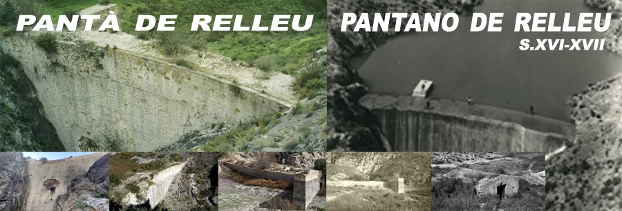
PANTANO RELLEU = BIC. CHANGE.ORG
https://www.change.org/p/president-de-la-generalitat-valenciana-conceller%C3%ADa-de-cultura-declaración-de-bien-interes-cultural-bic-pantà-de-relleu-pantano-de-relleu-s-xvii-xviii?utm_source=embedded_petition_view
20171106-DIFUSION DEL BIC PANTANO DE RELLEU CICCP Valencia a 6 Noviembre 2017_5pags
20171106-RELLEU.PANTANO-Old mills hidraulics in the upper Amadorio River. Relleu_11pags.pdf
https://relleupantano.blogspot.com.es/2017/11/20171106-relleupantano-old-mills.html
20171106-RELLEU.PANTANO-_6 HYDRAULICS IN THE OLD MILLS VALLEY OF RELLEU_xM.Salgot I M.Soler_9pags
https://relleupantano.blogspot.com.es/2017/11/20171106-relleupantano-6-hydraulics-in.htmlAURORA ass. Relleu. The hydraulic mills in the upper Amadorio. October 2016
10170324-RELLEU.PANTÀ-_PaperID_58_Prevention of flood episodes al Relleu_22a24.03.2017xJFCliment-MASoler-MSalgot_10pags.
20170322-RELLEU.PANTANO._ASSESSMENT OF THE PRESENT STATE AND PERSPECTIVES OF_Turquia_xxJFCliment_MSalgado_MASoler_10pags
https://relleupantano.blogspot.com.es/2017/11/20170322-relleupantanoassessment-of.html
20170507-BIC Pantano de Relleu Colegio de Ingenieros de Caminos, Canales y Puertos de Alicante - Mayo 2017 x Manolo Soler.
https://relleupantano.blogspot.com.es/2017/07/20170507-bic-pantano-de-relleu-colegio.html
20171106-RELLEU- a VALENCIA en el salón de actos del * Colegio de Ingenieros de Caminos, Canales y Puertos de la Comunidad Valenciana*-
20171106-RELLEU- a VALENCIA en el salón de actos del * Colegio de Ingenieros de Caminos, Canales y Puertos de la Comunidad Valenciana*-
https://relleupantano.blogspot.com.es/2017/07/20170507-bic-pantano-de-relleu-colegio.html
20170417-RELLEU- PANTANO DE RELLEU: -PETICIÓN DE FIRMAS APOYANDO LA DECLARACIÓN DE BIEN DE INTERÉS CULTURAL DE LA COMUNIDAD VALENCIANA Y PATRIMONIO DE LA HUMANIDAD-
20171106-RELLEU-PRESA :.- a VALENCIA en el salón de actos del * Colegio de Ingenieros de Caminos, Canales y Puertos de la Comunidad Valenciana*- https://relleupantano.blogspot.com.es/2017/11/20171106-relleu-valencia-en-el-salon-de.html
PANTANO RELLEU = BIC. CHANGE.ORG
No hay comentarios:
Publicar un comentario